Bohuslavice (Distrik Prostějov)
Tampilan
Bohuslavice | |
|---|---|
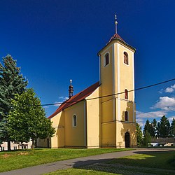
 Gereja Saint Bartholomew | |
| Koordinat: 49°37′15″N 16°57′27″E / 49.62083°N 16.95750°E | |
| Negara | |
| Region | Olomouc |
| Distrik | Prostějov |
| Pertama disebut | 1288 |
| Luas | |
| • Total | 4,87 km2 (1,88 sq mi) |
| Ketinggian | 409 m (1,342 ft) |
| Populasi (2021-01-01)[1] | |
| • Total | 445 |
| • Kepadatan | 91/km2 (240/sq mi) |
| Zona waktu | UTC+1 (CET) |
| • Musim panas (DST) | UTC+2 (CEST) |
| Kode pos | 798 56 |
| Situs web | www |
Bohuslavice adalah kotamadya dan desa di Distrik Prostějov di Region Olomouc, Republik Ceko. Desa memiliki sekitar 400 penduduk.


