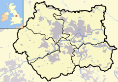
Chapel Allerton
Tampilan
53°50′09″N 1°32′24″W / 53.835888°N 1.540071°W
| Chapel Allerton | |
 Stainbeck Corner, pusat dari Chapel Allerton |
|
| Population | 18.206 |
|---|---|
| Ref. grid OS | SE303378 |
| Distrik metropolitan | Leeds |
| County metropolitan | West Yorkshire |
| Region | Yorkshire and the Humber |
| Negara konstituen | Inggris |
| Negara berdaulat | Britania Raya |
| Kota pos | LEEDS |
| Distrik kode pos | LS7 |
| Kode telepon | 0113 |
| Polisi | West Yorkshire |
| Pemadam kebakaran | West Yorkshire |
| Ambulans | Yorkshire |
| Parlemen UE | Yorkshire and the Humber |
| Parlemen Britania Raya | Leeds Timur Laut |
| Daftar tempat: Britania Raya • Inggris • Yorkshire | |
Chapel Allerton adalah sebuah daerah suburban di pinggiran kota Leeds, West Yorkshire, Inggris. Daerah ini berjarak 2 mil (3.2 km) ke arah timur laut dari pusat kota. Daerah pemilihan Chapel Allerton meliputi daerah yang disebut termasuk sebagai Chapeltown dan Potternewton - daerah pinggiran umumnya dianggap hanya bagian utara dari daerah ini. Penduduk wilayah ini diperkirakan 18.206 jiwa dalam sensus tahun 2001.[1]
Referensi
[sunting | sunting sumber]Pranala luar
[sunting | sunting sumber]Wikimedia Commons memiliki media mengenai Chapel Allerton.
- chapelallerton.org
- Chapel Allerton Conservation Area Appraisal and Management Plan Diarsipkan 2011-07-09 di Wayback Machine.
- Chapel Allerton: a short history Diarsipkan 2010-07-05 di Wayback Machine. BBC website
- chapel-a.com Community discussion forum, reviews and directory.
- YEP Chapel Allerton Community Website Diarsipkan 2011-07-12 di Wayback Machine.
- Wikivoyage Leeds/Chapel Allerton

