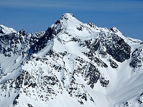
Piz Calderas
Tampilan
| Piz Calderas | |
|---|---|
 View from the south-west | |
| Titik tertinggi | |
| Ketinggian | 3.397 m (11.145 ft) |
| Puncak | 1.085 m (3.560 ft)[1] |
| Isolasi | 165 km (103 mi)[2] |
| Puncak induk | Piz Kesch |
| Masuk dalam daftar | Alpine mountains above 3000 m |
| Koordinat | 46°32′11.1″N 09°41′45.6″E / 46.536417°N 9.696000°E |
| Geografi | |
| Letak | Graubünden, Switzerland |
| Pegunungan | Albula Alps |
Piz Calderas adalah sebuah gunung di Pegunungan Alpen Albula, yang menghadap ke Mulegns di kanton Graubünden. Ini adalah puncak tertinggi dari kelompok yang terletak di antara Julier dan Albula Pass. Di sisi timurnya terdapat Val Bever.
Lihat juga
[sunting | sunting sumber]Referensi
[sunting | sunting sumber]- ^ Retrieved from the Swisstopo topographic maps. The key col is the Albula Pass (2,312 m).
- ^ Retrieved from Google Earth. The nearest point of higher elevation is west of Piz Kesch.
Tautan eksternal
[sunting | sunting sumber]Wikimedia Commons memiliki media mengenai Piz Calderas.

